Map Shows Antarctica Without Ice and Snow
Map Shows Antarctica Without Ice and Snow
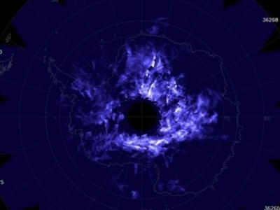
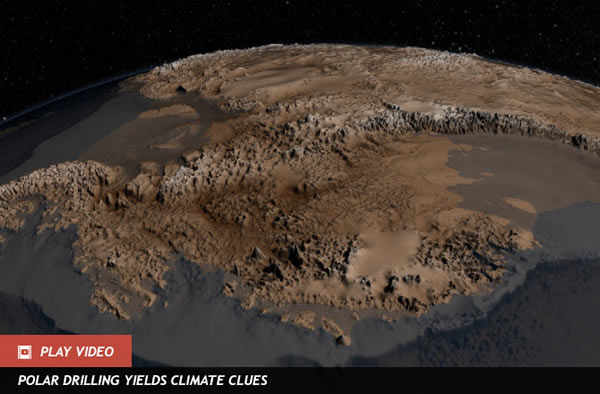
What does Antarctica look like in its underwear? A team at the British Antarctic Survey working with NASA pulled together decades of data to show us a virtual map without all the ice and snow. For the first time, the continent’s bare topography is revealed.
The Bedmap2 is a new virtual map created from substantial amounts of data that included recent measurements from airborne missions as well as satellites. The project, led by British Antarctic Survey scientist Peter Fretwell, relied on NASA’s Operation IceBridge, which has recorded Antarctica’s surface elevations, ice shelf limits and ice thickness. The new map led to some unexpected discoveries about the southernmost continent.
Not only is the volume of ice in Antarctica 4.6 percent greater than previously thought but the deepest point turns out to be under Byrd Glacier ― about 1,300 feet deeper than the spot that had been called the deepest, according to research Fretwell and his colleagues recently published in the scientific journal The Cryosphere (PDF).
The Bedmap2 could also help humanity in the future. Study co-author Hamish Pritchard pointed out that understanding the actual height and thickness of the ice as well as the landscape underneath will be fundamental to modelling the ice sheet. ”Knowing how much the sea will rise is of global importance, and these maps are a step towards that goal,” he told the British Antarctic Survey.
Over at NASA, interactive images show how the continent currently appears, and using a slider you can see the Bedmap2 topography below. There’s also a feature comparing the original Bedmap from 10 years ago with the newest one. Visualizing what’s below the frozen landscape is impressive, as long as it doesn’t end up being a snapshot of our planet’s shirtless future.(Jun 7, 2013 05:38 PM ET // by Alyssa Danigelis)