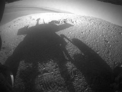
Curiosity's Longest Mars Drive in One Day: 464 Feet
Curiosity's Longest Mars Drive in One Day: 464 Feet
NASA’s Mars Science Laboratory is really beginning to rip up the Martian regolith, traveling 464 feet (141.5 meters) in one day ― its longest drive in a single sol (a Martian day) since the mission touched down last year.
The one-ton wheeled rover accomplished this feat on Sept. 5 (sol 385 of the mission) in two segments ― the first was a long, pre-planned route mapped out by engineers, but the second segment was navigated autonomously by Curiosity itself. The second segment took the rover over 138 feet (42 meters) of rocky terrain using only the robot’s onboard smarts. To put that distance in perspective, both segments allowed the rover to travel 100 feet further than the length of a football field (which is 360 feet long).
“We had a long and unobstructed view of the hill we needed to climb, which would provide an overlook of the first major waypoint on our trek to Mount Sharp,” said Jeff Biesiadecki, rover planner at NASA’s Jet Propulsion Laboratory, Pasadena, Calif. “We were able to extend the drive well beyond what we could see by enabling the rover’s onboard hazard avoidance system.”
After Curiosity’s “smart” trek, mission managers evaluated Curiosity’s performance and then completed the drive on Sept. 8 with a 80 feet (24.3 meter) rove to the crest of a rise nicknamed “Panorama Point.” From Curiosity’s vantage point, the first of five stopovers for the mission on its way to the base of Aeolis Mons (known as “Mount Sharp”) ― a 3.4 mile (5.5 kilometer) high mountain in the center of Gale Crater, the region of Mars Curiosity is exploring ― could be seen.
The first stopover along the 5.3 mile (8.6 kilometer) route to Mount Sharp is called “Waypoint 1″ and was selected from observations snapped by NASA’s Mars Reconnaissance Orbiter (MRO). The location has a pale-toned outcrop that may be of significant geological interest, so Curiosity will carry out science operations in the area.
Curiosity has already accomplished its prime scientific goal of revealing evidence of a past Martian environment that could support the evolution of microbial life in a shallow depression known as “Yellowknife Bay” in the Glenelg area, 1,300 feet (400 meters) east of Curiosity’s Aug. 5, 2012, landing site “Bradbury Landing.”
“We want to know how the rocks at Yellowknife Bay are related to what we’ll see at Mount Sharp,” said the mission’s project scientist, John Grotzinger of the California Institute of Technology, Pasadena. “That’s what we intend to get from the waypoints between them. We’ll use them to stitch together a timeline ― which layers are older, which are younger.”
Once Curiosity finishes its work at Waypoint 1, it has a multi-month trek to the base of its ultimate goal, Mount Sharp.
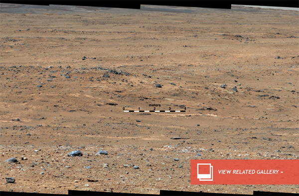
Image: An outcrop visible as light-toned streaks in the lower center of this image has been chosen as a place for NASA’s Mars rover Curiosity to study for a few days in September 2013. Credit: NASA/JPL-Caltech/MSSS(Sep 11, 2013 09:33 AM ET // by Ian O'Neill)